These maps were originally produced in 2007, to show the proposed growth of the tar sands, according to announced and officially proposed mega project components of the gigaproject. These maps have since been updated and exist as such here UPDATED 2009 Continental Pipeline Maps
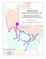 Existing infrastructure related to the tarsands gigaproject as of 2005. |
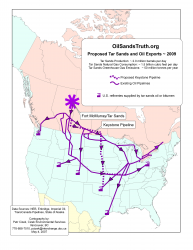 Proposed and existing infrastructure related to the tarsands gigaproject currently set to exist as of 2009. |
|
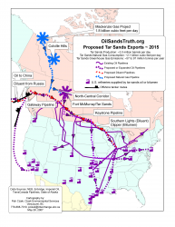 Proposed and existing infrastructure related to the tarsands gigaproject currently set to exist as of 2015. |
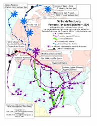 Proposed, existing and conceived infrastructure related to the tarsands gigaproject set to exist as of 2030. |
Feel free to copy, redistribute and otherwise reproduce any and all of these maps, but do not alter them.